 Whakatane
Sidebar
Whakatane
Whakatane Map + FREE Softbait Knots
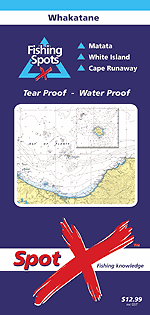
Hydrographic chart covers Waihi Estuary in the west to Cape Runaway in the east. White island is shown in a detailed insert. Whakatane, Rurima and Whale Island are also clearly shown.
Description
•Hydrographic chart covers Waihi Estuary in the west to Cape Runaway in the east. White island is shown in a detailed insert. Whakatane, Rurima and Whale Island are also clearly shown.
•The fishing Consultant for this chart is Rick Pollock, skipper of "Pursuit," one of New Zealands most successful charter boats. Rick operates out of Whakatane Harbour.
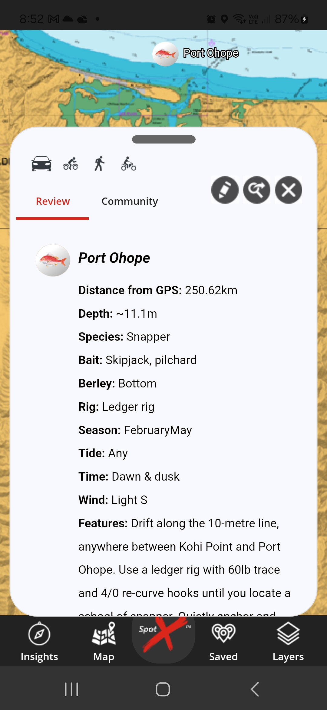
•21 fishing spots reviewed with GPS marks, illustration of recommended boat position, target species, bait, rig and best conditions with fishing technique tips.
•Plus an additional 15 fishing spots.
•Chart includes a review on local boat ramps and the location of camp grounds.
•Water proof, Tear proof.
•Folds out from a handy pocket size to a manageable (A2) size.
Related Products


Sales price: $12.99
Clearly illustrated rigs and easy to follow instructions on how to tie the knots used in these rigs.
Custom prototype for related products